Antique print from c.1890
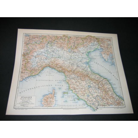
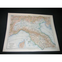
Italien.
Map from the end of the 19 century, from a german encyclopedia (so all titles and texts in german). Fold marks in the middlle of the print. Good condition. Italy.
Date of publication : 1890
Author : Meyers
Sheet marks :
11.4 inch X 9.04 inch
Plate marks :
10.22 inch X 8.25 inch
Antique print from c.1890