
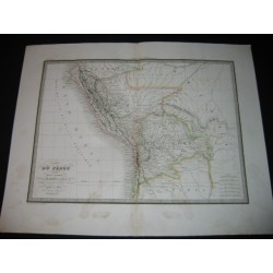
Map of Peru and high Peru.
Original print from the 19th c.
Map of Peru and high Peru. Geographic map drawn up by Lapie, geographer of the king. Stamp. Some watercolor highlights. Central fold. Dust stains in the bottom margin.
Date of publication : 1829
Author : Lapie
Sheet marks :
26.72 inch X 20.44 inch
Plate marks :
21.22 inch X 15.72 inch
Map of Peru and high Peru.
Original print from the 19th c.