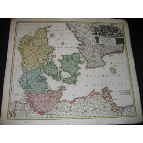
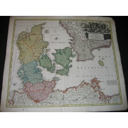
Original antique print from 18th c.
Map published at Nuremberg, from Atlas Novus, terrarum orbis imperia.
Engraved by Homann (1664 Kambach-Nuremberg 1724).
Nice map handcolored from time.
Central fold.
Margins little dirty. Denmark.
Date of publication : 1730
Author : Jean Baptiste Homann
Sheet marks :
24.37 inch X 20.83 inch
Plate marks :
22.01 inch X 18.86 inch
Original antique print from 18th c.